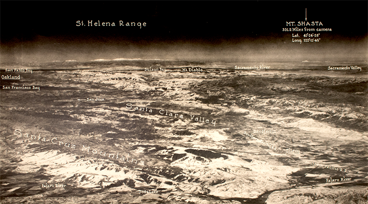
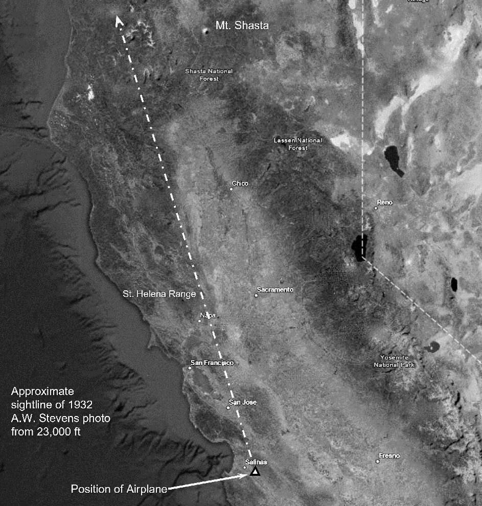
Albert W. Stevens Photo From 23,000 Feet
Albert W. Stevens was an aerial photographer, balloonist and U.S. Army officer. Born in Belfast, Maine in 1886, he received a bachelor’s degree in electrical engineering in 1907 and a master’s degree in 1909 from the University of Maine.
Stevens, a U.S. Army officer, balloonist, and early aerial photographer, took the first photograph of Earth’s curvature (1930) and the first photographs of the Moon’s shadow on the Earth during a solar eclipse (1932). On November 11, 1935, Stevens made a record balloon ascent with Captain (later Lieutenant General) Orvil Anderson at Rapid City, South Dakota, attaining a height of 72,395 feet (22,066 metres). That altitude record was unequaled until 1956.
Paul’s new favorite is this 1932 photo, part of Fogler Library’s A. W. Stevens collection, taken about eight miles east of Salinas, California at an altitude of 23,000 feet. The photo captures Mt. Shasta from a distance of 331.2 miles, and covered the greatest amount of the earth’s surface, 7200 square miles, that had ever been encompassed by a single photographic exposure.
An article about Stevens and his record flights appeared in the May 1932 issue of The Maine Alumnus magazine. Another in-depth article by Stevens, “Exploring the Stratosphere,” appeared in National Geographic Magazine in October, 1934 (Vol. 66, No. 4, p. 397-434).
For more information, contact Special Collections by phone at 207.581.1686 or email um.library.spc@maine.edu.