Cataloging: Maps
Purpose: to give an overview and procedures for general original map cataloging at the University of Maine. Includes map cataloging resources.
Definitions of Common Map Types
- AERIAL PHOTO: always refers to a bare photograph. The service provider may add interpretive information, but the main service is the photo itself. Almost always of scales larger than approx. 1:2,000 (anything else does not show enough detail for the purposes it is usually used for: forest management, town planning, highway development, etc.). Specifications may include: cloudless, leaf-off, side-lit from the East [or West].
- ORTHOPHOTOQUAD MAP: a printed display, usually of a fixed scale and physical size for its series, which shows land and water features by means of an aerial photograph. Each quadrangle is usually identified by a standard naming system (the same as topographic maps). Generally of an intermediate (≥ 1:10,000) or small scale (≥ 1:100,000). It is considered a “map” because: a) it follows the standard size and naming system of the equivalent topographic maps, b) it is “rectified”—hence the prefix “ortho”—to remove distortion caused by the angle from which the photo was taken, and c) interpretive information is provided in the map collar and often on the map itself (e.g., grid lines, river and lake names).
- PHOTO MAP: nearly the same as orthophotoquad maps, but it is not the term used by the U.S. Geological Survey (USGS). May not have a standardized scale, physical size and naming system. May not even be rectified, leading to possible distortion due to the angle from which the airplane camera shot the photo.
- PICTORIAL MAP: map that shows features by means of pictorial symbols (e.g., the town maps used as place mats at restaurants in tourist towns showing shops and attractions by means of small pictures or cartoons). Can be any scale. Could show, for example, symbols for the major products of each U.S. state by means of pictures placed over the state.
- REMOTE SENSING: any depiction of the Earth done from any height, but generally from great aircraft heights, or from space via artificial satellites. This does not imply small scale, as some of these images show amazing detail and/or high enough resolution to support zooming in to very large scales.
- TOPOGRAPHIC MAP: a printed display, usually of a fixed scale and physical size for its series, which shows land and water features by means of symbols and colors and elevations and depths by means of concentric curvilinear symbols called contour lines. Each quadrangle is usually identified by a standard naming system. Generally of an intermediate (≥ 1:10,000) or small scale (≥ 1:100,000).
Additional Resources for Map Identification
- Guidelines for Distinguishing Cartographic Electronic Resources from other Electronic Resources (Library of Congress)
- Glossary of Cartographic Terms (University of Texas)
- Multiformat materials that include maps
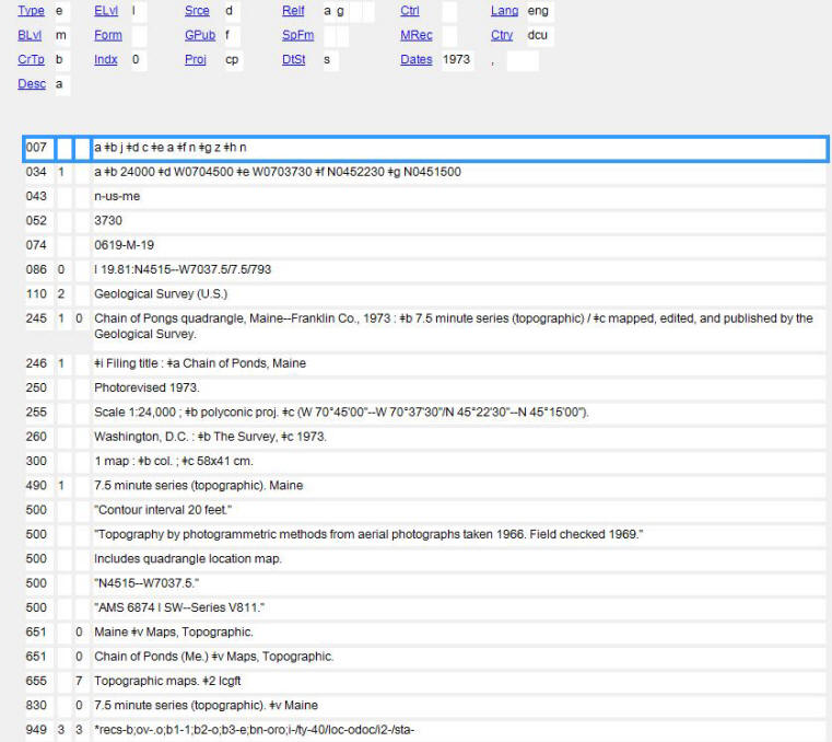
MARC Quick Reference
| Field | Description | Example | Reference |
| 007 | Physical Description Fixed Field | 007 __ a ‡b j ‡d c ‡e a ‡f n ‡g z ‡h n | OCLC |
| 034 | Coded Cartographic Mathematical Data | 034 1_ a ‡b 22000000 ‡d W1800000 ‡e E1800000 ‡f N0840000 ‡g S0700000 | OCLC ; Scale Calculator |
| 043 | Geographic Area Code | 043 __ n-us-me | OCLC ; Codes |
| 052 | Geographic Classification | 052 __ 3733 ‡b A5 | OCLC ; LC Class. Schedule G |
| 255 | Cartographic Data | 255 __ Scale 1:7,500,000 ‡c (W 125°–W 65°/N 49°–N 25°). | OCLC ; Scale Calculator |
| 300 | Physical Description | 300 __ 1 map : ‡b both sides, col., rayon ; ‡c 69 x 53 cm. on sheet 48 x 57 cm. | OCLC |
Note Fields, Ordering of
From AACR2, Section 3.7: “Make notes as set out in the following subrules and in the order given there. However, give a particular note first when it has been decided that note is of primary importance.”
- Nature and scope of the item (3.7B1)
- Language (3.7B2) — See also MARC 546
- Source of title proper (3.7B3)
- Variations in title (3.7B4)
- Parallel titles and other title information (3.7B5)
- Statements of responsibility (3.7B6)
- Edition and history (3.7B7)
- Mathematical and other material specific details (3.7B8)
- Publication, distribution, etc. (3.7B9)
- Physical description (3.7B10)
- Accompanying material (3.7B11)
- Series (3.7B12)
- Dissertations (3.7B13) — See also MARC 502
- Audience (3.7B14)
- Other formats (3.7B16)
- Contents (3.7B18) — See also MARC 505
- Numbers (3.7B19)
- Copy being described, library’s holdings, etc. (3.7B20) — See also MARC 59x
- “With” notes (3.7B21) — See also MARC 501
MARC 5xx Note Fields Reference (OCLC)
Exporting Map Catalog Records to URSUS via Sierra
Use the following codes for exporting map records from OCLC to URSUS or for creating new records in Millenium:
Mat type = u (map)
I-Type = 19 (map)
loc = omap (regular collections)
loc = ospc (special collections)
Sample command lines:
94933*b1-u;b2-o;b3-8;bn-oro;loc-ospc/ty-19/sta-o/ [Special Collections]
94933*b1-u;b2-o;b3-8;bn-oro;i-/loc-omap/ty-19/ [Stacks]
Additional Map Cataloging Resources
- Library of Congress Geography and Map Reading Room
- Mathematical Data for Bibliographic Descriptions of Cartographic Material and Spatial Data (Koninklijke Bibliotheek, Netherlands)
- Oregon State University Map Cataloging Page
- Western Association of Map Libraries’ Map Librarians’ Toolbox
- USGS National Geologic Map Database
Return to Technical Services Table of Contents.